ohsome-planet: Export OSM data and its history to GeoParquet: The GIScience Research Group at Heidelberg University and HeiGIT have released version 1.0.0 of #ohsome-planet, a tool for #cloudnative access to #OpenStreetMap (#OSM) data using the #GeoParquet format. Originally developed as an internal tool, it...
https://spatialists.ch/posts/2025/04-11-ohsome-planet-export-osm-data-and-its-history-to-geoparquet/ #GIS #GISchat #geospatial #SwissGIS
spatialists.ch – geospatial newsohsome-planet: Export OSM data and its history to GeoParquet – spatialists.ch – geospatial news
More from  Spatialists


 We have just released 𝗼𝗵𝘀𝗼𝗺𝗲-𝗽𝗹𝗮𝗻𝗲𝘁, a new software library on GitHub that facilitates the transformation of raw OpenStreetMap history data into the 𝗚𝗲𝗼𝗣𝗮𝗿𝗾𝘂𝗲𝘁 format, making it more accessible and efficient for spatial data analysis.
 A short read on what ohsome-planet can do:
  The ohsome-planet software library:
 Multi-Attribute Queries: Check completeness for multiple attributes at once.
 ohsome dashboard:
  ohsome quality API:
  How up-to-date is road data in
  Map by Benjamin Herfort, Lara De Simone, Jonas Danner
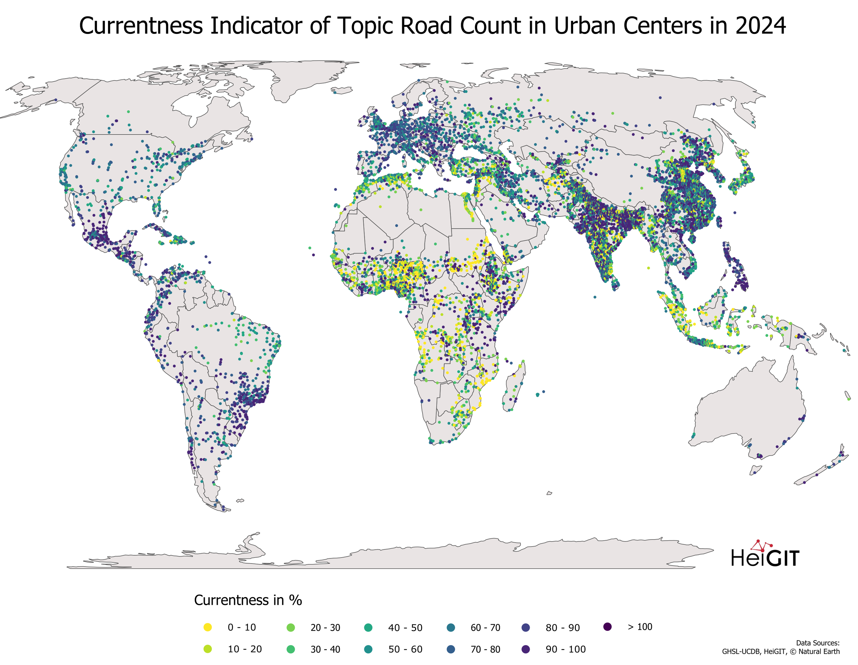

 Excited to share our
  Dive into our FOSSGIS talks (in German)
 Mit openrouteservice zu RoutingPlus – Einblicke in einen globalen Routing-Cluster
  ohsomeNow stats v1.0 blogpost:
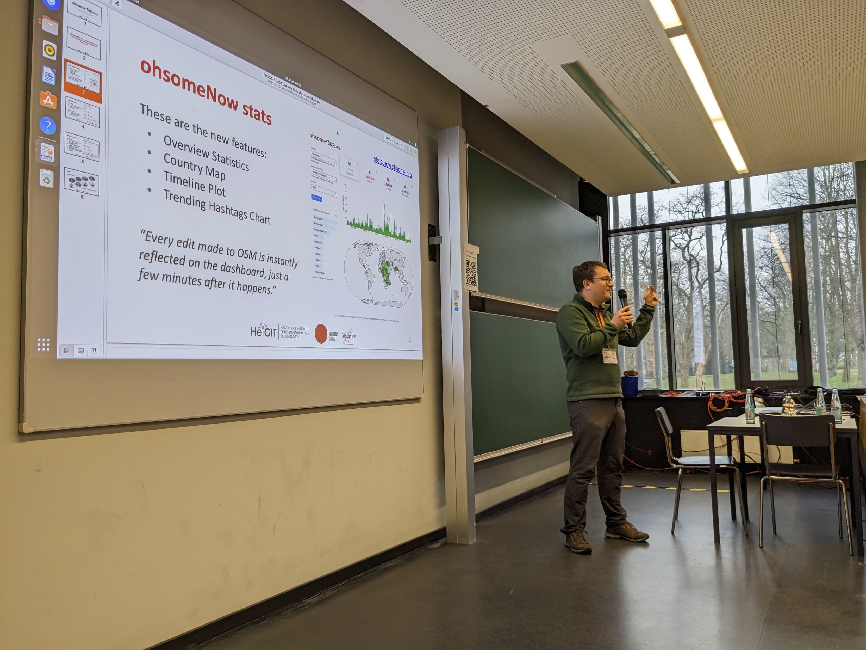

 More exciting news!
 Now featuring live mode for
 Also make sure to watch our explanatory video!
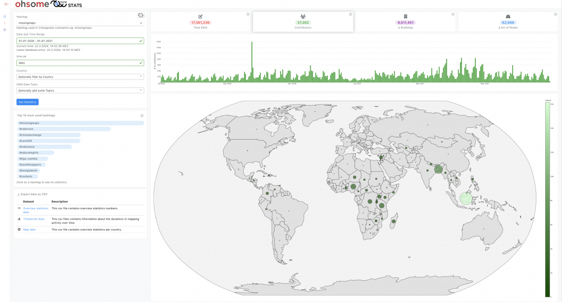
 If you are looking for an alternative, check out our
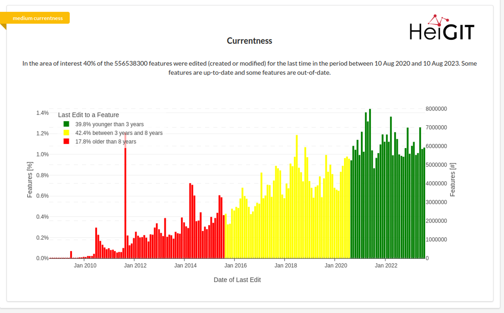
  How up-to-date (currentness) are buildings in OSM?
 This figure considers all(!!!) 500+ million buildings in

 ️
️
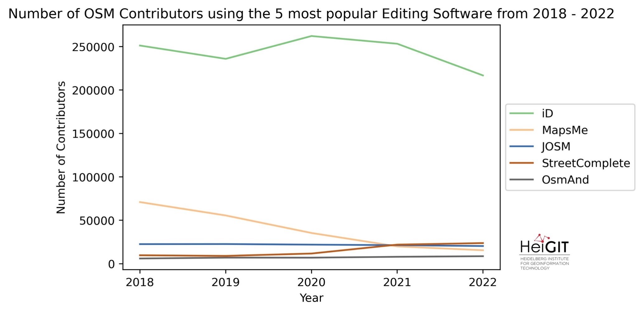
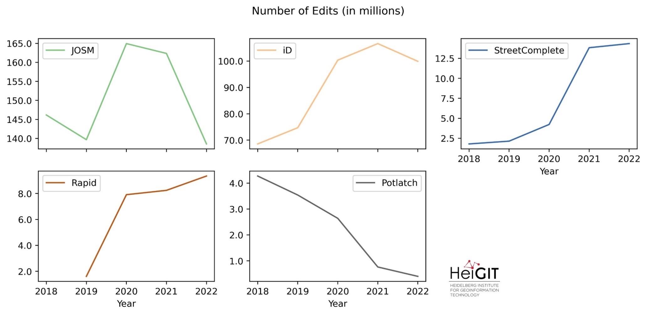
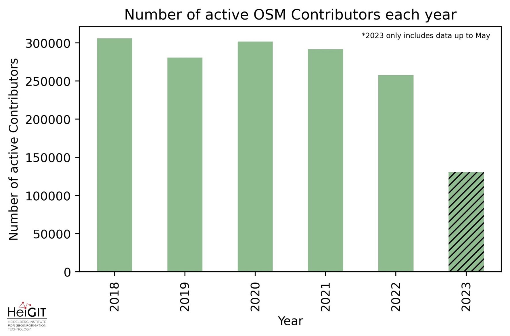
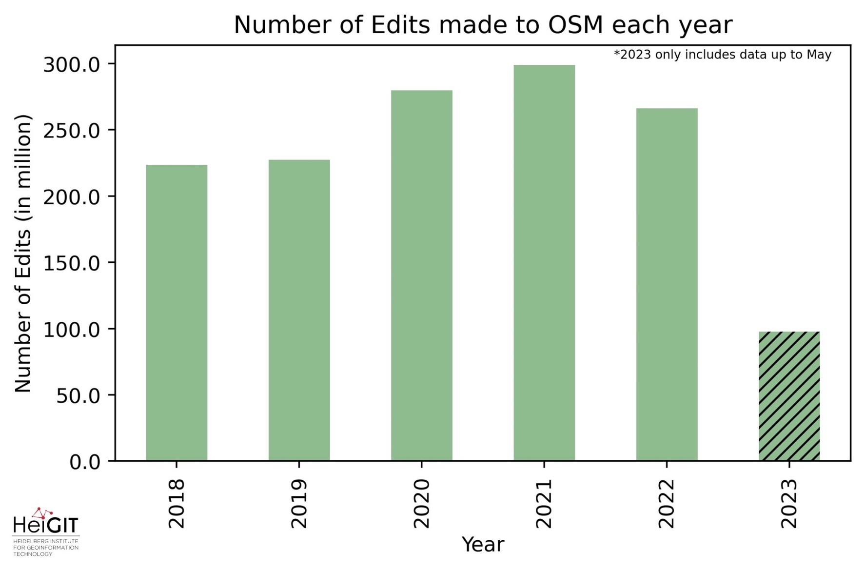
 By combining data from OSHDB and the OSM changeset DB we've created a dataset, offering valuable insights.
 We examined edits, contributors, and the software used by OSM mappers.